
File:Burundi physical map.svg

Size of this PNG preview of this SVG file: 549 × 599 pixels. Ither resolutions: 220 × 240 pixels | 440 × 480 pixels | 703 × 768 pixels | 938 × 1,024 pixels | 1,876 × 2,048 pixels | 851 × 929 pixels.
Oreeginal file (SVG file, nominallie 851 × 929 pixels, file size: 696 KB)
Ootline
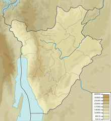
| Descreeption | Map of Burundi, parameters equivalent to File:Burundi_location_map.svg |
| Date | |
| Soorce | Ain wirk |
| Author | Urutseg |
Licensin
I, the copyright holder of this work, hereby publish it under the following license:
| This file is made available under the Creative Commons CC0 1.0 Universal Public Domain Dedication. | |
| The person who associated a work with this deed has dedicated the work to the public domain by waiving all of their rights to the work worldwide under copyright law, including all related and neighboring rights, to the extent allowed by law. You can copy, modify, distribute and perform the work, even for commercial purposes, all without asking permission.
|
File history
Clap oan ae date/time fer tae see the file aes it kithed at that time.
| Date/Time | Thummnail | Dimensions | Uiser | Comment | |
|---|---|---|---|---|---|
| current | 16:51, 11 Mairch 2011 | | 851 × 929 (696 KB) | Urutseg |
Eimage airtins
The follaein pages airts tae this image:
Global file uisage
The follaein ither wikis uise this file:
- Uisage on ar.wikipedia.org
- Uisage on az.wikipedia.org
- Uisage on ba.wikipedia.org
- Uisage on bg.wikipedia.org
- Uisage on bn.wikipedia.org
- Uisage on bs.wikipedia.org
- Uisage on ce.wikipedia.org
- Uisage on ckb.wikipedia.org
- Uisage on cs.wikipedia.org
- Uisage on de.wikipedia.org
- Uisage on de.wikivoyage.org
- Uisage on el.wikipedia.org
- Uisage on en.wikipedia.org
- Gitega
- Kirundo Province
- Kagera waterfalls
- Mount Kikizi
- Rusizi National Park
- Ruvubu National Park
- Mount Heha
- Bururi Forest Nature Reserve
- Module:Location map/data/Burundi/doc
- Commune of Bugabira
- Commune of Busoni
- Commune of Kirundo
- Module:Location map/data/Burundi
- Lake Mwungere
- Murehe Forest
- Lake Narungazi
- Protected Aquatic Landscape of the North
- Lake Kanzigiri
- Lake Rwihinda
- Kabanga, Burundi
- Lake Gitamo
- Lake Gacamirindi
- Uisage on eo.wikipedia.org
View mair global usage o this file.